Fact-Checking Pokémon GO Landmarks: Urban Mapping Breakthrough or Privacy Nightmare?

Millions of players walking through public parks holding smartphones upright look like ordinary mobile gamers catching digital monsters. What they are actually doing is executing the largest volunteer land-surveying project in human history. As detailed in a recent Science News Explores Report, everyday smartphone users have constructed dense, centimeter-accurate three-dimensional representations of public spaces around the globe.
Ten years into its lifecycle, the game has evolved well past the simple GPS-coordinate matching of 2016. In-game rewards like Rare Candies, Poké Balls, and anniversary drops motivate users to circle statues, historical markers, and storefronts while recording short video sweeps. Beneath that loop of casual entertainment sits a complex proprietary infrastructure converting sensory input into commercial spatial data.
📌 Key Takeaways:
- The Underlying Infrastructure: Short user-recorded camera sweeps of Gym and PokéStop landmarks feed directly into Niantic's 3D spatial mapping engine rather than sitting idle on local hardware.
- Privacy Realities: Niantic strips faces and vehicle registration plates on upload, but raw geospatial paths, device telemetry, and spatial point clouds remain permanently archived on corporate servers.
- The Dual-Use Economy: The crowdsourced data creates both real-time in-game visual occlusion and commercial mapping tools licensed to third parties through the Niantic Visual Positioning System.
How Casual AR Scans Became Industrial Cartography
The process begins innocuously with a field research task. A player taps a PokéStop, receives an assignment marked "AR Mapping," walks thirty steps around a bronze bust, and presses record. The app records an orbital path across fifteen to thirty seconds, capturing roughly thirty video frames per second alongside gyroscope, accelerometer, and magnetometer data.
Once connected to Wi-Fi, the device uploads this telemetry packet directly to Niantic's processing pipeline. The game's engine uses structure-from-motion photogrammetry to extract millions of distinct visual keypoints from contrasting angles. Those static visual fragments transform into a spatial mesh: a machine-readable geometry file showing curbs, benches, staircase angles, and wall boundaries.
This engine does not run on arbitrary locations. Points of interest must qualify through Niantic Wayfarer, a community-driven curation dashboard where high-level players review community submissions. To become an active landmark, a location must meet strict PokéStop nomination criteria: permanent public artwork, unique local businesses, historical markers, or community transit hubs. Over a decade of play, this filter has systematically cataloged millions of the most culturally active pedestrian junctions across several continents.
What Niantic's Privacy Disclosures Actually Permit
Public suspicion often centers on surveillance fears: does the app secretly record living rooms or spy on bystanders? Reviewing Niantic’s published terms of service and developer privacy policies reveals a nuanced legal reality that differs from common conspiracy theories.
Niantic’s data ingestion pipeline automatically blurs human faces and vehicle license plates before committing recordings to deep storage. Scans taken on private single-family residential properties are technically barred by automated geofencing rules and manual reviewer rejections.
The primary exposure lies instead in cumulative geospatial data privacy risks. When players scan a landmark, the uploaded bundle includes:
- Exact time-stamped GPS coordinates accurate to within three meters.
- Device altitude, heading, and rotational velocity vectors.
- Hardware identifiers coupled to user account credentials.
- Dense structural meshes of public thoroughfares, including shop entryways and public transit entrances.
While Niantic states it does not sell raw personal identification data to third-party data brokers, the resulting 3D coordinate meshes belong entirely to the company. Through augmented reality cartography, players forfeit ownership of the physical geometries they document. What begins as a community-sourced effort to enhance local gameplay becomes corporate proprietary spatial equity.
A Decade of Spatial Scanning: 2016, 2026 Evolution
The shift from simple two-dimensional map layers to sub-meter 3D meshes was deliberate, progressing across distinct technological phases.
| Phase & Era | Mapping Architecture | Data Source & Scope | Primary Commercial Purpose |
|---|---|---|---|
| Flat GPS Era(2016, 2018) | 2D road networks, basic coordinate pinning via OpenStreetMap data. | Public OSM contributors; legacy Ingress portal submissions. | Basic location-based gameplay, local business sponsorships. |
| Point Cloud Era(2019, 2022) | Monocular photogrammetry, static mesh generation from user camera feeds. | Early AR Mapping quests; targeted scans of popular Gyms and PokéStops. | AR occlusion (characters hiding behind real trees and walls). |
| Dynamic VPS Era(2023, 2026) | Centimeter-level positioning via Niantic Visual Positioning System (VPS). | Millions of overlapping community scans, multi-angle seasonal sweeps. | Enterprise spatial licensing, robotics, autonomous delivery routing. |
Early iterations relied almost entirely on open-source vector maps. Today, the platform operates a living spatial index that updates continually through player activity.
Trespassing Disputes, Boundary Drifts, and Inappropriate Geofences
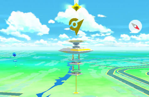
Mapping the real world via crowdsourcing comes with friction. Over the past decade, private property trespassing disputes have triggered formal legal settlements. In the United States, class-action litigation compelled the developer to establish an official removal pipeline for homeowners whose front yards were turned into contested virtual real estate.
Real-world landmark verification remains imperfect. Community reviewers on Niantic Wayfarer frequently approve ambiguous markers, and automated systems miss bad inputs. In early 2026, gaming communities uncovered a live PokéStop situated within the private boundaries of Little St. James (Epstein Island). The incident highlighted an enduring issue: crowdsourced coordinates can persist inside forbidden or private territories for years until public scrutiny forces manual intervention.
Location-based gaming regulations are tightening in response. European and East Asian municipal bodies have begun examining whether sustained commercial mapping in high-traffic memorial parks, military buffer zones, and private plazas breaches spatial sovereignty rules. Municipalities want clear boundaries regarding where games can direct player foot traffic, especially when corporate value is extracted from every step taken.
Inside the Niantic Visual Positioning System Marketplace
Why collect these scans when players simply want to complete special research tasks or participate in community celebrations? The commercial logic points straight to the Niantic Visual Positioning System (VPS).
Standard GPS chips in smartphones possess an error radius of three to ten meters. In dense urban canyons, signals bounce off glass facades, causing digital avatars to drift wildly. VPS solves this issue visually. When a device points its camera at a VPS-activated landmark, the software identifies key architectural vertices and matches them against pre-calculated 3D point clouds. Localization occurs in under thirty milliseconds, delivering sub-centimeter accuracy.
Niantic licenses this localization layer to third-party developers through its developer platform. Enterprise customers can build:
- Outdoor augmented reality city tours with persistent digital signs.
- Micro-navigation systems guiding pedestrians directly to specific subway platforms.
- Spatial anchor frameworks for future augmented reality eyewear.
- Visual guidance pathways for small delivery robotics.
The business model flips traditional digital mapping. Conventional tech firms spend hundreds of millions operating fleets of dedicated camera cars and sensor-equipped aircraft. Niantic built an equivalent spatial asset inventory essentially for free, subsidized by the enthusiasm of players hunting digital collectibles.
Frequently Asked Questions (FAQ)
Q1: Does scanning a PokéStop upload live footage of bystanders directly to public servers?
A1: No. The application runs local pre-processing routines that detect and blur human faces and vehicle license plates before sending data packages over Wi-Fi. The resulting database stores spatial feature vertices (geometric point clouds) rather than unedited, human-identifiable consumer video streams.
Q2: Can I play Pokémon GO without contributing spatial mapping data to Niantic?
A2: Yes. AR Mapping tasks are optional field research assignments. You can delete or ignore AR scanning quests without penalty. Standard gameplay features like catching, raiding, and trading function entirely through regular GPS telemetry without activating the camera scanner.
Q3: What recourse do property owners have if their location is incorrectly flagged as a landmark?
A3: Owners can submit an official location removal request through Niantic’s dedicated web portal. Under terms established by legal settlements, requests accompanied by proof of ownership or verified single-family residential boundaries require developer processing and removal within specified administrative windows.
Navigating Spatial Rights in the Augmented Era
The line dividing recreational gaming from commercial geospatial intelligence has permanently thinned. What began in 2016 as a spontaneous hunt across city sidewalks has transformed into a sustained, industrial-scale cartography initiative. Millions of players voluntarily scan historic plazas, train stations, and public parks every week, trading thirty-second camera sweeps for in-game progression.
This system delivers tangible utility: it produces precise spatial anchors that make digital interactions align cleanly with the physical world. Yet it also operates on an asymmetric bargain. Everyday pedestrians do the physical labor of scanning city streets, while the underlying intellectual property and commercial value of those detailed spatial models remain securely held behind corporate walls. When you point your camera at a neighborhood landmark to earn a handful of virtual supplies, you are playing a game, but you are also building the proprietary real-world map of the next technological decade.
