Gujo Yoshida River Live Camera Directory: Complete Access, Fishing Hotspots, and Safety
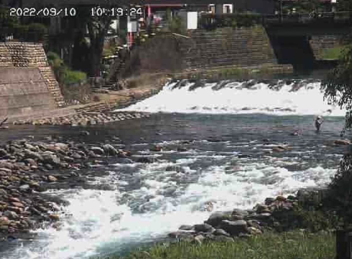
High in the mountains of Gifu Prefecture, the Yoshida River cuts directly through the castle town of Gujo Hachiman before merging into the main stem of the Nagara River. Renowned across Japan for crystal-clear waters and wild sweetfish (ayu), this alpine drainage can transform within an hour of an isolated torrential downpour. For anglers wading upstream, touring motorcyclists winding through mountain passes, and travelers seeking riverside traditional inns, reliable visual confirmation of water conditions is an operational necessity. As highlighted in a recent BikeJIN WEB on MSN Report, travelers navigating the Yoshida River basin increasingly combine localized surveillance technology with secure lodging, such as the Minshuku Takahashi, which pairs covered garages and security setups with direct access to the river's banks.
Access to operational webcams along the Yoshida River now spans multiple municipal, prefectural, and national agencies. Rather than scouring disconnected Japanese administrative portals, visitors require a single, unified reference point to interpret live visual feeds alongside hydrometric data.
📌 Key Takeaways:
- Core Network: Real-time monitoring across the Yoshida River relies on feeds maintained by the Ministry of Land, Infrastructure, Transport and Tourism (MLIT) and the Gifu Prefectural River Disaster Prevention Center.
- Critical Landmark: The Miyagase Bridge live cam serves as the definitive reference point for central Gujo Hachiman water levels, clarity, and recreational swimming activity.
- Angler Protocol: Ayu sweetfish feeding halts when turbidity climbs; visual stream surveillance allows anglers to assess water clarity before driving into the valley.
- Traveler Logistics: Extreme mountain weather requires cross-referencing visual cameras with radar rainfall data and securing covered lodging during localized squalls.
The Mountain Drainage Network Behind Gujo's Rapid Water Shifts
The Yoshida River begins in the high elevations of Mount Dainichi and meanders roughly 30 kilometers southwest before emptying into the Nagara River. Because the surrounding catchment basin features steep, forested slopes with shallow topsoil, heavy precipitation produces immediate runoff. Water that falls on the ridgelines reaches the main channel in minutes.
During the summer months, local microclimates frequently trigger localized thunderstorms known as guerrilla downpours (gerira gōu). A clear sky directly above Gujo Hachiman often conceals intense rain just 8 kilometers upstream in Meihou. Without monitoring upstream feeds, anyone standing along the rocky gravel banks faces abrupt surges. The integration of high-definition stream monitors gives travelers a clear view of upstream conditions before water begins to rise downstream.
Essential Surveillance Feeds Along the Yoshida River Corridor
The surveillance network along the Yoshida River combines public flood-prevention feeds with community tourism cameras. The primary visual anchor sits at Miyagase Bridge (Miyagase-bashi), spanning the heart of Gujo Hachiman. This camera captures both the concrete foundations of the bridge and the iconic rocky outcrop where local youths leap into the stream during the annual Gujo Odori festival.
Further upstream, the Meihou camera network provides crucial early warnings. Because water travels from Meihou down to central Gujo in approximately 45 to 60 minutes during elevated flows, checking the Meihou station offers a functional head start. Downstream, the confluence camera at the Nagara River junction tracks backwater effects, where swollen Nagara waters can slow down and pool the mouth of the Yoshida, creating hazardous eddies along popular fishing banks.
| Monitoring Station | Managing Agency | Optimal Angling Flow | Flood Advisory Level |
|---|---|---|---|
| Miyagase Bridge (Central Gujo) | Gifu River Disaster Prevention | 0.45 m, 0.65 m | 1.80 m |
| Meihou Kodate (Upper Reach) | MLIT Chubu Regional Bureau | 0.30 m, 0.50 m | 1.40 m |
| Nagara Confluence (Hachiman Minami) | Gujo Municipal Emergency Office | 0.80 m, 1.10 m | 2.50 m |
| Akasaka Bridge (Downstream) | Gifu River Disaster Prevention | 0.50 m, 0.75 m | 2.10 m |
Ayu Sweetfish Windows and Turbidity Thresholds
The Nagara River basin represents the cultural epicenter of Japanese tomoburi fishing, a specialized technique using a live decoy sweetfish to trigger territorial strikes from wild ayu. Success in this sport hinges entirely on water clarity. Ayu feed on diatom algae scraped from submerged river stones. When upstream mudslides or highway construction runoff increase turbidity, the fish cease grazing and retreat into deep resting pools.
Anglers monitoring the live stream feeds look for two distinct visual indicators: gravel bar definition and bridge pier visibility. On the Miyagase Bridge camera, if the underwater footing of the central support column is invisible from the surface, turbidity levels exceed 15 NTU (Nephelometric Turbidity Units). At that level, traditional tomoburi becomes practically impossible.
A dropping river with emerald-tinted translucence indicates ideal water conditions. By tracking camera stills refreshed every 10 minutes, anglers travelling from Nagoya, Kansai, or Tokyo avoid wasted trips across the central highlands.
Touring Basecamps and Riverside Hospitality Infrastructure
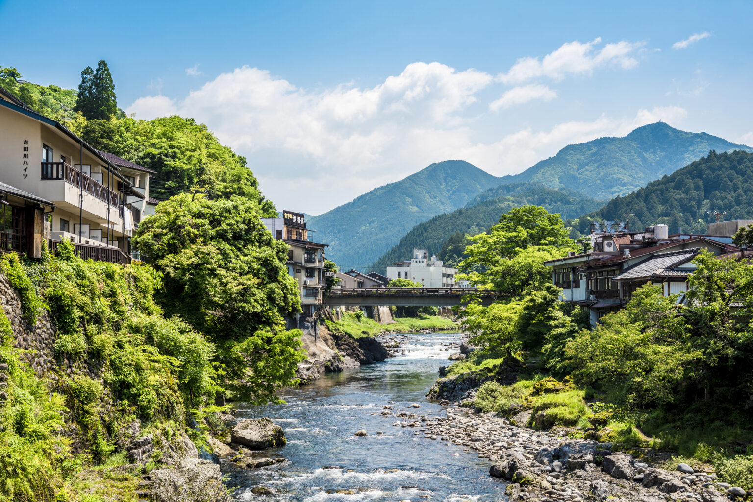
The roads shadowing the Yoshida River, particularly National Route 472, commonly known as the Seseragi Highway, rank among the top scenic motorcycle and driving routes in central Honshu. The narrow mountain passes present distinct physical hazards during cloudbursts, including debris washed across asphalt and saturated gravel beds.
Consequently, hospitality providers throughout Gujo have adapted specifically to handle gear-heavy travelers who need immediate shelter when river conditions sour. Establishments along the watercourse, such as the aforementioned Minshuku Takahashi, offer covered, monitored parking structures to protect machinery from sudden alpine downpours while situating guests within earshot of the river.
Staying directly beside the Yoshida allows travelers to verify water conditions visually from their lodgings at sunrise. When the water runs clear and calm, wading conditions are optimal. If the current turns muddy brown and carries woody debris, travelers can alter their itineraries to higher, paved mountain trails instead.
Reading Official Japan Water Data Alongside Visual Feeds
A camera frame displays water color and surface velocity, but it cannot convey total discharge volume. The most effective safety strategy combines live video feeds with hydrometric telemetry from the Ministry of Land, Infrastructure, Transport and Tourism (MLIT) River Information System.
The MLIT online dashboard tracks water depth in centimeters relative to a historical baseline zero mark. A steady water level reading of 0.52 meters at the Miyagase monitoring post signifies safe, predictable seasonal conditions. If telemetry logs a vertical rise of 30 centimeters over 20 minutes, an evacuation order is imminent, even if the camera still shows patches of clear water near the banks.
Always cross-reference the camera stream with high-resolution precipitation radars. The Japan Meteorological Agency (JMA) High-Resolution Precipitation Nowcasts display rain cell movement at 250-meter grid resolutions. When radar shows red and purple storm cells tracking northeast into the Dainichi mountains, anglers and swimmers along the Yoshida should exit the water immediately, regardless of what the local webcam currently shows.
Frequently Asked Questions (FAQ)
Q1: Where can I access the official Miyagase Bridge webcam online without a subscription?
The Miyagase Bridge feed is hosted publicly by the Gifu Prefectural River Disaster Prevention Center and mirrored on the Gujo City Tourism portal. It refreshes every 3 to 10 minutes depending on server load, with no paywall or login required.
Q2: Why does the Yoshida River turn cloudy even when it is not raining in Gujo Hachiman?
The Yoshida River drains an extensive mountain watershed extending into Meihou and Mount Dainichi. Thunderstorms frequently stall over the high-elevation headwaters while downtown Gujo remains dry, pushing silt and muddy runoff downstream within an hour.
Q3: What are the legal requirements for wading and fishing in the Yoshida River?
Anyone fishing for ayu, amago, or iwana must purchase a recreational fishing permit (*yūgyoken*) issued by the Gujo Fisheries Cooperative. Day permits cost between 2,000 and 3,000 yen and are available at local convenience stores, tackle shops, and through authorized riverbank wardens.
Navigating the Yoshida River Basin in Changing Mountain Climates
The Yoshida River remains one of Japan's most pristine waterways, but its alpine origin demands respect and constant situational awareness. By coupling visual feeds from bridges like Miyagase with official MLIT hydrometric readings and radar data, visitors can experience the rich culture, clear waters, and riverside hospitality of Gujo Hachiman without falling victim to sudden mountain flash floods. Check the operational camera feeds before departure, monitor the weather radar while on the water, and respect the rapid shifts of Gifu's highland river systems.
